
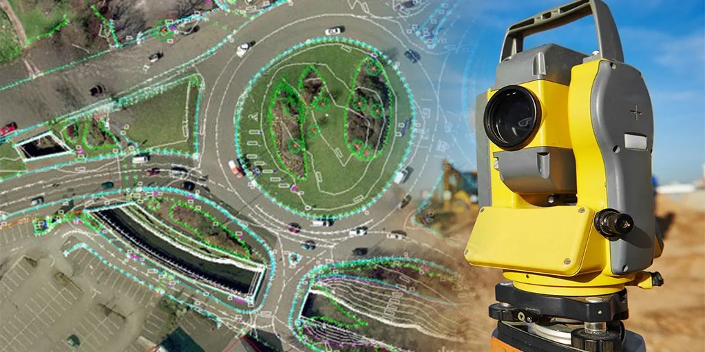
01 · Illustration
Topographic survey plan
Levels, contour lines, spot levels and existing features as AutoCAD DWG/DXF and PDF, on the agreed datum and grid.
Surveying & Site Measurement — 01
A topographic survey (also called a topographical survey) records the exact shape of the land (levels, contours and existing features), giving designers a true picture of the site before work begins.
Dervoss provides topographic survey across Dubai, the UAE and Saudi Arabia, captured and produced by one in-house team.
Real Dervoss work
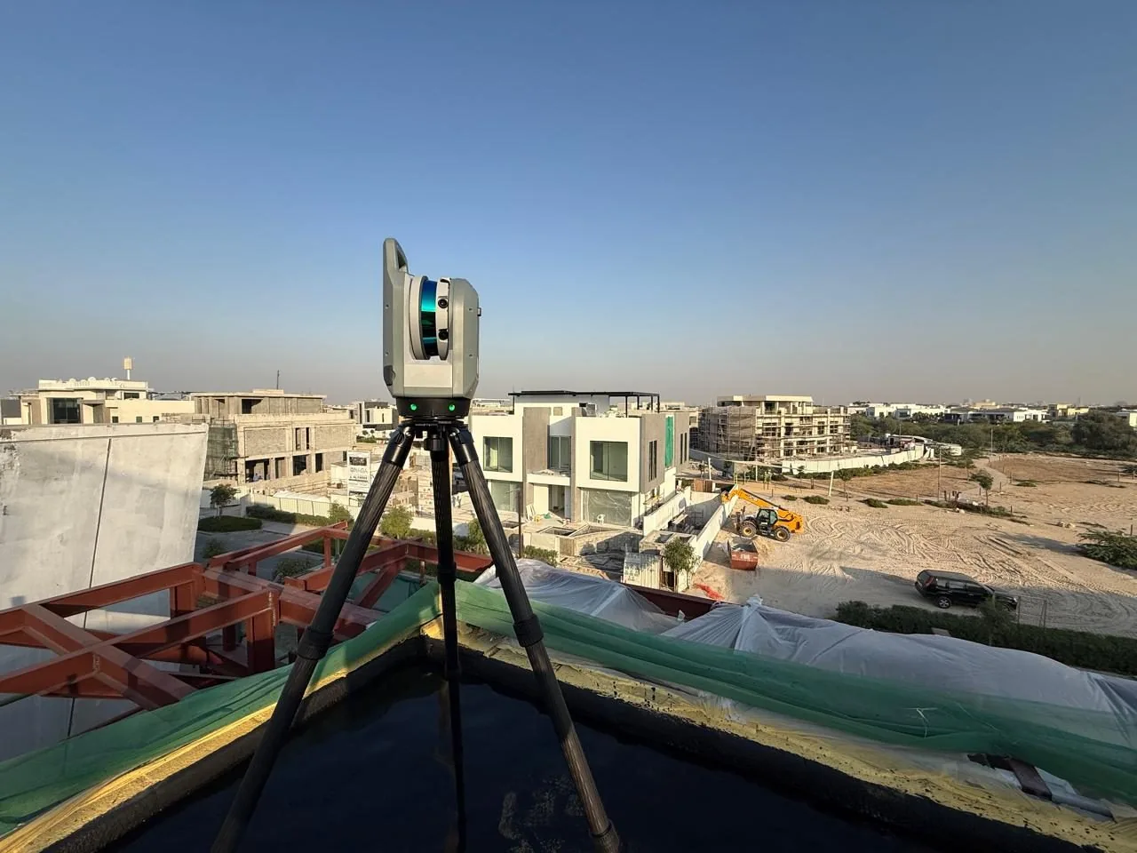
Dervoss on site
02 — What you receive
3 deliverables
01 · Illustration
Levels, contour lines, spot levels and existing features as AutoCAD DWG/DXF and PDF, on the agreed datum and grid.
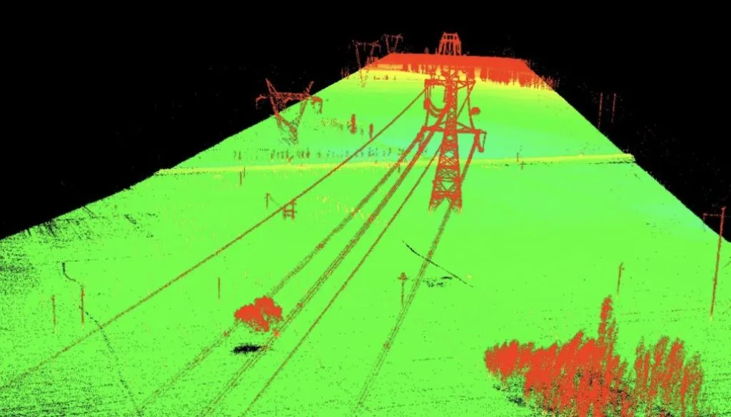
02 · Real Dervoss deliverable
Existing structures, services covers, trees, roads and boundaries-as-found, plus a digital terrain model your engineers can design and calculate volumes against.

03 · Illustration
Control network, methodology and achieved accuracy documented per project; GIS layers (SHP) available on request.
Formats
PDFDWG / DXFDTMSHP (on request)03 — When you need it
01
Architects and engineers need verified levels and features to design on.
02
Levels decide where water goes; guesswork here is expensive.
03
Gate-level and planning submissions need accurate site data.
04
Roads, utilities and earthworks start from the existing terrain.
Site photo · Dervoss
04 — Real project · Dubai
Large infrastructure corridors (roads, rail, utility and power lines) are slow and unsafe to survey on foot, yet design, earthworks and progress checks all need consistent data along the whole route.
The project team received terrain and surface models for route planning, earthworks and volume calculations, drainage and grading analysis, and as-built records of the corridor.
Whole corridor in one dataset · terrain models ready for BIM and GIS
Read the case study05 — How it works
Step 01
We survey or scan your site with survey-grade instruments: every surface and dimension captured in a single visit, with minimal disruption.
Step 02
The field data is processed, registered and checked into one accurate dataset, the verified foundation everything else is built on.
Step 03
Our in-house team produces your deliverables (drawings, maps, reports or Revit models), reflecting exactly what is on site.
Step 04
You receive your files in the agreed formats, with an accuracy statement. We stay available for revisions and questions after handover.
06 — In detail
A Dervoss topographic package is design-ready on day one: the topographic plan with contour lines and spot levels in DWG/DXF and PDF, the feature survey showing everything that exists on and around the plot, a digital terrain model for drainage and volume work, and a survey report stating the control network used and the accuracy achieved.
Everything sits on a documented control network, on the datum your project uses, which is what makes the survey usable for authority submissions and for setting out later, not just for the first design sketch. The drawings are prepared authority-ready: format, title block, coordinate system, elevation datum and file naming follow your consultant’s requirements for Dubai Municipality, Trakhees or the relevant authority, and your consultant handles the submission itself.
Most Dubai topographic surveys start from the plot’s affection plan, the official plan that fixes the plot’s boundary, dimensions and coordinates. The survey then records what is actually on and around the plot: ground levels, structures, kerbs, trees, service covers and the levels of the roads it connects to. In Dubai, drawings are delivered on the DLTM grid (Dubai Local Transverse Mercator) used by Dubai Municipality; in Abu Dhabi, Sharjah and the other emirates, on the coordinate system your project or authority specifies.
Contour interval is agreed per project. On flat UAE sites 0.5 m or 1 m is typical, with closer intervals and a grid of spot levels where drainage or detailed grading matters. The interval, datum and control network are all stated in the survey report, so the drawings can be reused for setting out later.
A topographic survey shows the service covers it can see; it can’t show the pipes and cables between them. If the design involves new connections, piling or excavation, add a GPR utility survey in the same visit. Both are drawn on the same control network, so the levels, features and located services arrive as one coordinated plan.
Much of what’s searched as “land survey Dubai” is really two different services. If you need the shape of your land (levels, features, terrain for design and planning), that’s a topographic survey, and that’s us. If you need legal plot boundaries certified (cadastral / affection-plan work), that’s a government-licensed category we don’t currently offer, and you’ll need a surveyor from the Dubai Land Department’s list of accredited surveying companies. We’d rather tell you that in one paragraph than after a site visit. For everything your designers, engineers and contractors need from the ground, see also the which-survey guide, and when the survey needs to cover large or hard-to-access terrain, we combine ground methods with drone LiDAR and photogrammetry.
The topographic survey is the start of the site’s measurement chain, not the end of it. Once the design is fixed, a setting out survey marks the design onto the ground from the same control network: gridlines, levels, corners and offsets the contractor builds to. A verification survey later checks what was built against what was designed, on that same control, so deviations are measured rather than argued, and a scan-based deviation report does the same for whole surfaces. That’s why the survey report states the control network explicitly: it is reused for the life of the project.
07 — Why Dervoss for topographic survey
One accountable team from site to finished deliverable: the people who survey your site produce your drawings and reports. No hand-offs, no subcontracted drafting, and a fixed quote with a committed delivery date.
01
No hand-off between a scanning company and an offshore drawing shop: the team that measured your site produces your deliverables.
02
Trimble X9 laser scanning and survey-grade instruments, accurate to ±2 mm, with an accuracy statement per delivery.
03
All seven emirates, Saudi Arabia and the wider GCC, with deliverables prepared for local authority requirements.
04
On site within 24 hours of a confirmed LPO; urgent concrete and utility scans often same-day.
08 — Questions
A topographic survey records the exact shape of the land (levels, contours and existing features), so designers work from a true picture of the site instead of assumptions.
Yes. Topographic survey, topographical survey and topography survey all mean the same thing: a survey of ground levels, features and existing structures. Dervoss delivers the same plans and terrain model whichever name your brief uses.
Ground levels and contours, existing structures, services covers, trees, roads and kerbs, and site boundaries as found on the ground. Everything a design team needs to know about the site as it exists.
Because every design decision (levels, drainage, access, setting out) depends on the real shape of the land. Designing on wrong levels is one of the most expensive mistakes a project can make.
A topographic survey maps the shape and features of your land for design. A cadastral land survey establishes legal plot boundaries, a licensed category we don't currently offer. For design, planning and construction data, the topographic survey is what you need; see the which-survey guide.
We establish survey control, then capture the site with total station, GNSS and 3D laser scanning as the terrain requires. Field data is processed into contour drawings, feature plans and a terrain model, checked against the control network before delivery, with the achieved accuracy stated in the survey report.
It depends on plot size, terrain, access and the deliverables you need. Send the plot details and you get a fixed quote, no hourly surprises.
Topographic plan (DWG/DXF + PDF) with contours and spot levels, feature survey, digital terrain model, and a survey report with accuracy statement (GIS layers on request), on the datum your project uses.
Typically about 5 working days for a standard plot. Larger sites, difficult access or extra deliverables take longer, and the quote states the date.
09 — Get a fixed quote
Describe the job in your own words; you don't need to know the right survey name. A fixed price and a committed delivery date, no obligation. Plans or photos? Send them on WhatsApp.
On site
Within 24 h of a confirmed LPO
Office
Al Barsha South 3, Dubai
Hours
Mon-Fri 10:00-18:00