
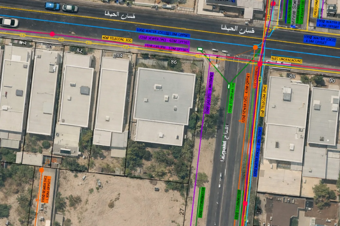
01 · Real Dervoss deliverable
Orthophoto map
A measurable, high-resolution aerial map of the whole site, as GeoTIFF, ready for CAD and GIS.
Drone & Aerial — 01
Drone surveying uses LiDAR and photogrammetry from the air to map large or hard-to-access sites quickly, producing accurate maps, models and volume measurements.
Dervoss provides drone surveys across Dubai, the UAE and Saudi Arabia: flights by a licensed partner operator, data processed and delivered by the Dervoss team.
Real Dervoss work
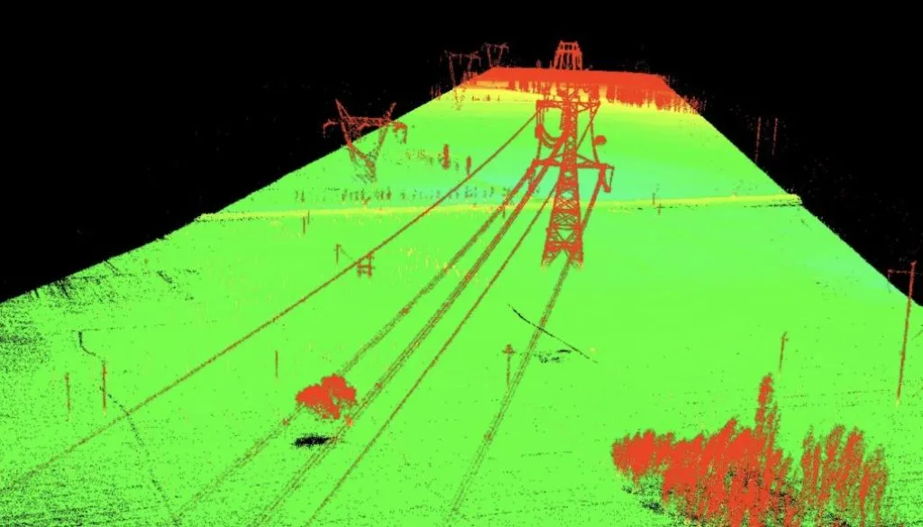
Real project: drone LiDAR point cloud of a power-line corridor, flown by a licensed partner, processed by Dervoss
02 — What you receive
3 deliverables
01 · Real Dervoss deliverable
A measurable, high-resolution aerial map of the whole site, as GeoTIFF, ready for CAD and GIS.
02 · Real Dervoss deliverable
DTM and contour drawings (DWG/DXF) ready for design and volume calculation, tied to ground control.
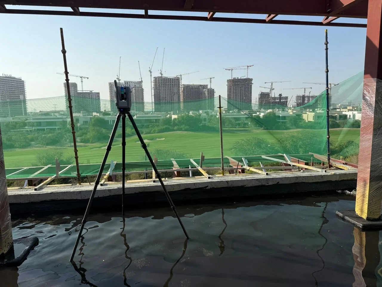
03 · Real Dervoss deliverable
Stockpile and earthworks quantities, documented and repeatable, plus point cloud (LAS/LAZ) for engineering use.
Formats
GeoTIFFDWG / DXFLAS / LAZPDF reports03 — When you need it
01
Days of ground survey become hours of flight.
02
Accurate volume reports for materials and earthworks.
03
Repeat flights document how the site changes over time.
04
Contours and terrain models over areas ground crews can't cover economically.
Site photo · Dervoss
04 — Real project · Dubai
Large infrastructure corridors (roads, rail, utility and power lines) are slow and unsafe to survey on foot, yet design, earthworks and progress checks all need consistent data along the whole route.
The project team received terrain and surface models for route planning, earthworks and volume calculations, drainage and grading analysis, and as-built records of the corridor.
Whole corridor in one dataset · terrain models ready for BIM and GIS
Read the case study05 — How it works
Step 01
We survey or scan your site with survey-grade instruments: every surface and dimension captured in a single visit, with minimal disruption.
Step 02
The field data is processed, registered and checked into one accurate dataset, the verified foundation everything else is built on.
Step 03
Our in-house team produces your deliverables (drawings, maps, reports or Revit models), reflecting exactly what is on site.
Step 04
You receive your files in the agreed formats, with an accuracy statement. We stay available for revisions and questions after handover.
06 — In detail
Much of the UAE’s “drone survey” market is aerial filming companies flying a camera over your site. The difference between a beautiful photo and a survey is ground control, stated accuracy and engineering-ready formats. A Dervoss drone survey is flown against surveyed ground control points, processed by the same team that delivers our terrestrial surveys, and shipped with an accuracy statement (typically around 2 to 3 cm with properly established ground control, verified per project): an orthophoto you can measure on, a terrain model you can design against, volumes you can invoice against.
Corridors and infrastructure alignments: kilometres of terrain captured in a morning, tied to control so every repeat flight is comparable. Earthworks and stockpiles: repeatable volume reports that end quantity disputes. Progress monitoring: the same flight plan flown monthly gives the project an objective visual and measurable record. And combined missions: drone for the wide area, topographic ground survey where detail and verified levels matter: one deliverable set, one accuracy statement.
A drone survey in Dubai usually means one of two things. A LiDAR survey uses a laser sensor on the aircraft and captures terrain precisely, including under vegetation; a drone photogrammetry survey builds measurable maps and models from overlapping photographs and is the better choice for open sites and visual records. Both are aerial surveys tied to surveyed ground control, and Dervoss delivers both with the same accuracy statement and the same formats: GeoTIFF orthophoto, LAS/LAZ point cloud, DWG/DXF contours. Typical corridor capture: several kilometres in a single morning flight.
07 — Why Dervoss for drone LiDAR & photogrammetry
One accountable team from site to finished deliverable: the people who survey your site produce your drawings and reports. No hand-offs, no subcontracted drafting, and a fixed quote with a committed delivery date.
01
No hand-off between a scanning company and an offshore drawing shop: the team that measured your site produces your deliverables.
02
Trimble X9 laser scanning and survey-grade instruments, accurate to ±2 mm, with an accuracy statement per delivery.
03
All seven emirates, Saudi Arabia and the wider GCC, with deliverables prepared for local authority requirements.
04
On site within 24 hours of a confirmed LPO; urgent concrete and utility scans often same-day.
08 — Questions
Mapping large or hard-to-access sites: orthophoto maps, terrain models, stockpile volumes and progress records, in a fraction of the time ground methods need.
Photogrammetry builds measurable maps and 3D models from hundreds of overlapping aerial photographs. Tied to surveyed ground control points, it produces survey-grade orthophotos and terrain models, not aerial photography repurposed as survey data.
With properly established ground control points, around 2 to 3 cm under suitable conditions. The actual figure depends on the site, the survey method and the ground control layout, so it is verified and stated per project. Where higher precision matters, we combine drone and ground methods.
Driven by site area, deliverables and permits. For large areas it's usually significantly cheaper than ground survey. Send the site boundary and you get a fixed quote.
Photogrammetry produces measurable photo-maps and works well on open sites; LiDAR penetrates vegetation and captures terrain more precisely. We recommend per site; often the answer is both.
For large open sites, stockpiles and corridors: yes, clearly. For small plots or interiors, ground methods win. We'll recommend whichever fits, and routinely combine the two.
Yes. Flights are carried out by a licensed partner operator, in accordance with applicable UAE aviation regulations and with the approvals each project requires. Dervoss processes the data and produces your deliverables.
Orthophoto map (GeoTIFF), point cloud (LAS/LAZ), contours and DTM (DWG/DXF), and volume reports, with an accuracy statement, in CAD- and GIS-ready formats.
09 — Get a fixed quote
Describe the job in your own words; you don't need to know the right survey name. A fixed price and a committed delivery date, no obligation. Plans or photos? Send them on WhatsApp.
On site
Within 24 h of a confirmed LPO
Office
Al Barsha South 3, Dubai
Hours
Mon-Fri 10:00-18:00