
Industries
LiDAR location scanning for film, VFX & virtual production
Dervoss laser-scans real locations in the UAE (factories, warehouses, plants and buildings) and delivers them as scale-true point clouds and meshes for VFX, matchmove and Unreal Engine work.
01 — Your situation
What are you trying to do?
01
“We need a scale-true digital double of a location”
02
“We need the scan as clean meshes for Unreal, Maya or Houdini”
03
“The location is a large exterior or rooftop”
02 — In detail
What you receive
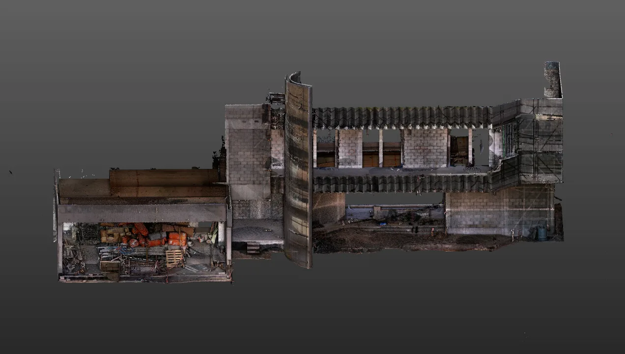
A scale-true point cloud. Every surface of the location captured as measured points, so environment work starts from real dimensions and proportions instead of estimates. This is what keeps matchmove and set extensions from drifting in scale.
Meshes at the detail you need. The point cloud converted into meshes for your pipeline, from lightweight proxy geometry for layout and previs to detailed environment geometry for final shots.
Collision-ready assets for Unreal Engine. Geometry prepared so virtual cameras, characters and physics behave correctly inside the scanned space.
Virtual scouting. The scanned location can be explored remotely for shot planning and blocking, without repeat site visits for the whole team.
How a location scan works
The location team shares the areas and the shots that matter. Scan positions are planned around access and the production schedule, and the space is captured position by position with a survey-grade laser scanner. The scans are registered into one point cloud on site-accurate scale, cleaned, and converted to the outputs your pipeline uses. The same team that captured the location prepares the data, so questions about a corner or a missing surface are answered from the field notes.
Why a survey company for VFX capture
Scanning a location for film uses the same equipment and the same discipline as scanning a building for engineering: control, registration and checked accuracy. What changes is the output. Dervoss does the 3D laser scanning and the point cloud processing in-house, so you get engineering-grade geometry in the format a VFX pipeline expects.
Site photo · Dervoss
03 — Real project · Dubai
Industrial location scanning for a film and VFX production
A production needed industrial locations (factories, power-plant style interiors and large warehouses) as accurate digital environments for VFX and Unreal Engine work, without sending the whole team back to site again and again.
Scan data that lets VFX teams build CG environments and virtual sets at correct scale, for camera moves, matchmove, lighting reference and set extensions, as well as virtual scouting and previs, without repeated site visits.
Scale-true digital locations · no repeat site visits
Read the case study04 — Questions
Questions we get asked
What do you deliver for VFX and Unreal work?
A registered point cloud at true real-world scale, plus meshes built from it at the level of detail the shot needs, from light proxy geometry to detailed environments. Collision-ready assets for Unreal Engine can be prepared from the same data. Tell us your pipeline and we deliver to it.
Why LiDAR instead of photogrammetry alone?
LiDAR measures geometry directly, so scale is right from the start and large plain, dark or repetitive surfaces don't break the model. Photogrammetry adds texture. Many productions use both, with the scan as the accurate base.
Can you work around a production schedule?
Yes. Scanning is fast and non-contact. Scan positions are planned with your location team, and capture can happen before, between or after shooting days.
Can you scan large exteriors?
Yes. Ground scanning covers buildings and interiors in detail. Large exteriors and rooftops can add drone capture, flown by a licensed partner operator and processed by Dervoss.
What kind of locations can you scan?
Industrial sites, warehouses, plant rooms, building interiors and exteriors: exactly the spaces that are slow to measure by hand. See the industrial location project.