
Industries
For infrastructure & utility projects
Infrastructure and utility work needs to know the ground: its levels, its features and what's already buried in it. Dervoss delivers the topographic, utility and aerial data that keeps roads, networks and power corridors moving.
01 — Your situation
What are you trying to do?
01
“We need terrain data along a corridor”
02
“We're trenching and need utility clearance”
03
“We need staged surveys as works progress”
04
“We need gridlines, levels and positions marked as works progress”
05
“Nearby works might be moving the structure”
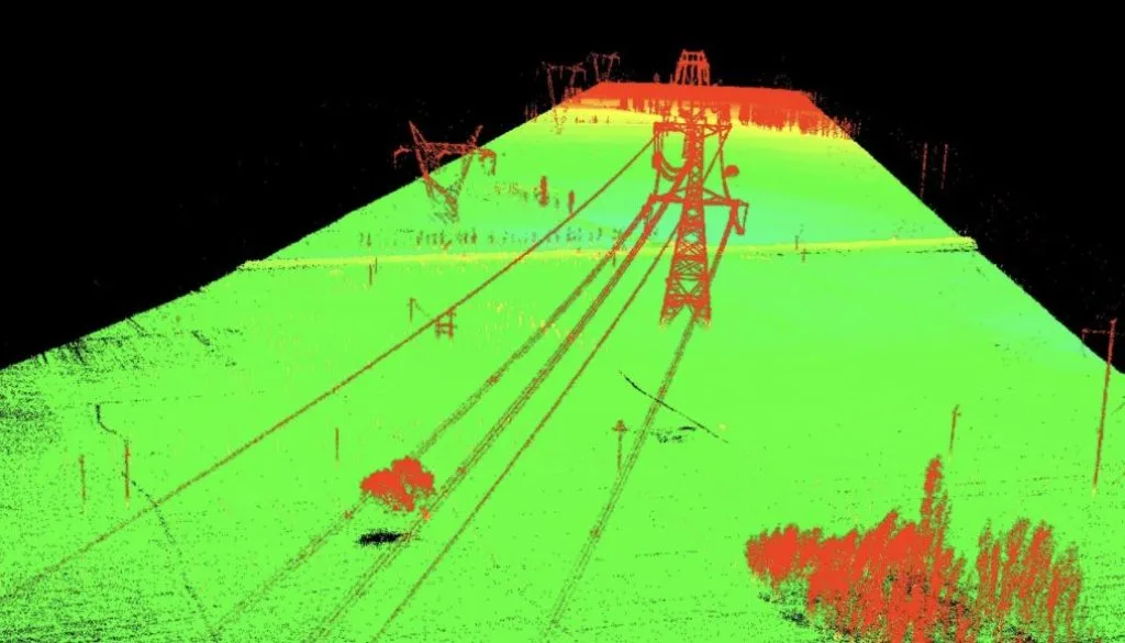
Site photo · Dervoss
02 — Real project · Dubai
Drone LiDAR survey for an infrastructure corridor
Large infrastructure corridors (roads, rail, utility and power lines) are slow and unsafe to survey on foot, yet design, earthworks and progress checks all need consistent data along the whole route.
The project team received terrain and surface models for route planning, earthworks and volume calculations, drainage and grading analysis, and as-built records of the corridor.
Whole corridor in one dataset · terrain models ready for BIM and GIS
Read the case study03 — Questions
Questions we get asked
Can you map long corridors efficiently?
Yes: drone LiDAR and photogrammetry over the corridor, tied to ground control for verified accuracy. Days of ground crew work become hours of flight.
How does utility clearance before trenching work?
We scan the alignment with GPR and electromagnetic detection, mark findings on the ground and deliver a clearance map. More on utility mapping.
Do you work on utility and energy projects?
Yes. Our projects include a drone LiDAR survey of a power-line corridor, and our utility surveys locate DEWA power cables, water mains, telecom ducts and district cooling pipes before excavation.
Can you do staged surveys as works progress?
Yes: repeat surveys and flights on a fixed schedule document progress and quantities, on the same control so every stage is comparable.