
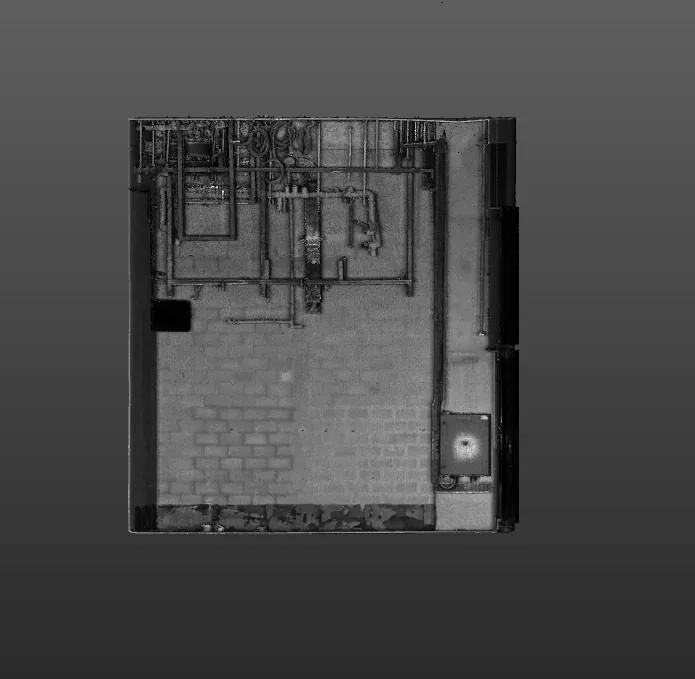
01 · Real Dervoss deliverable
Registered point cloud
Cleaned, aligned scan data as .RCP / .E57, ready to model from, with noise, people and reflections removed.
3D Scanning & BIM — 01
Point cloud processing turns raw laser-scan data into a clean, registered, ready-to-use point cloud for modelling, measurement and analysis.
Dervoss provides point cloud processing across Dubai, the UAE and Saudi Arabia, captured and produced by one in-house team.
Real Dervoss work
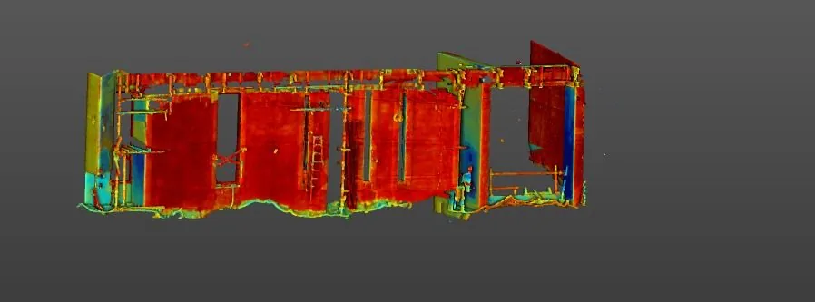
Real Dervoss point cloud (façade scan)
02 — What you receive
3 deliverables
01 · Real Dervoss deliverable
Cleaned, aligned scan data as .RCP / .E57, ready to model from, with noise, people and reflections removed.

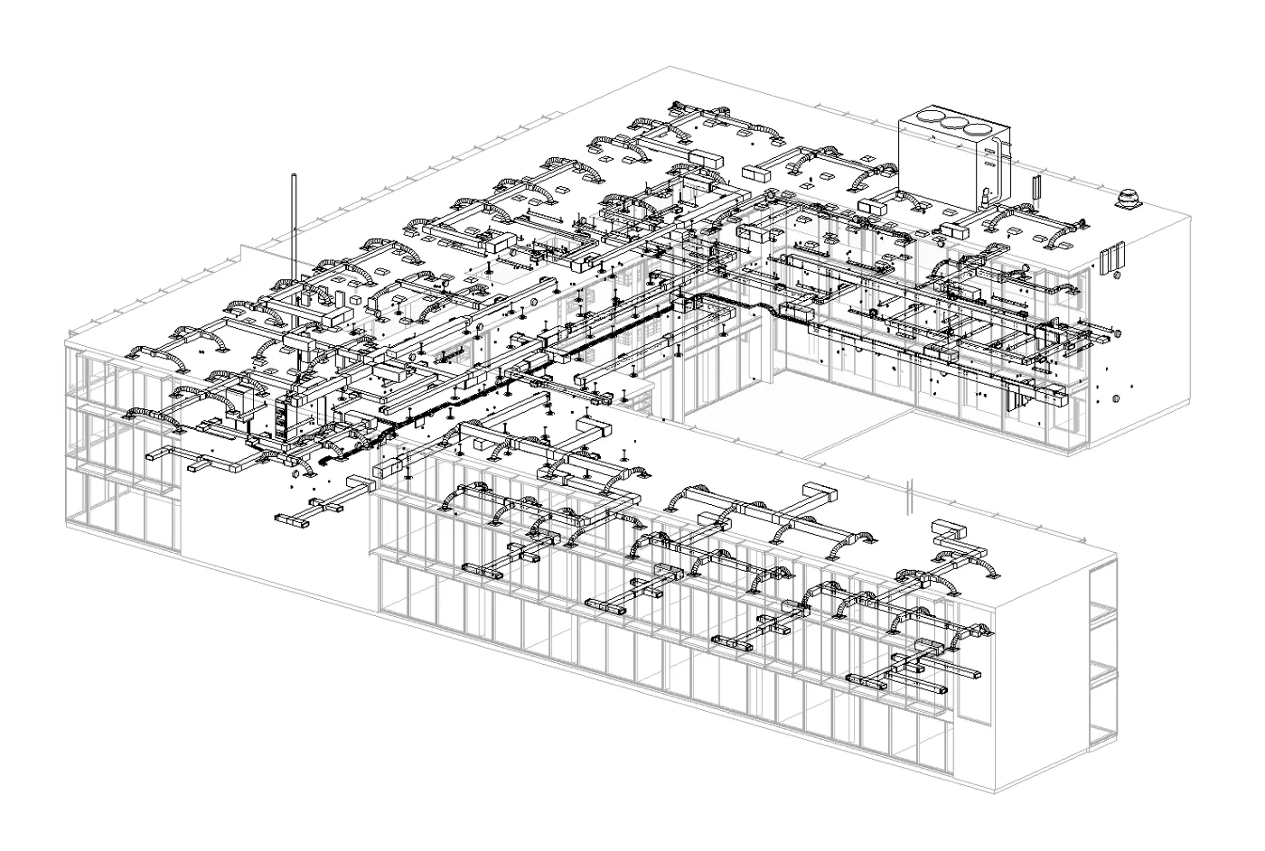
02 · Illustration
Registration quality documented per delivery; the figure is measured, not assumed.
03 · Real Dervoss deliverable
Conversions to the format your software needs (Revit, Navisworks, CAD or analysis tools).
Formats
.RCP.E57.XYZother formats on request03 — When you need it
01
Data captured but not yet usable for modelling or measurement.
02
Multiple scan positions need aligning into one accurate dataset.
03
Clean input is what makes downstream modelling fast and reliable.
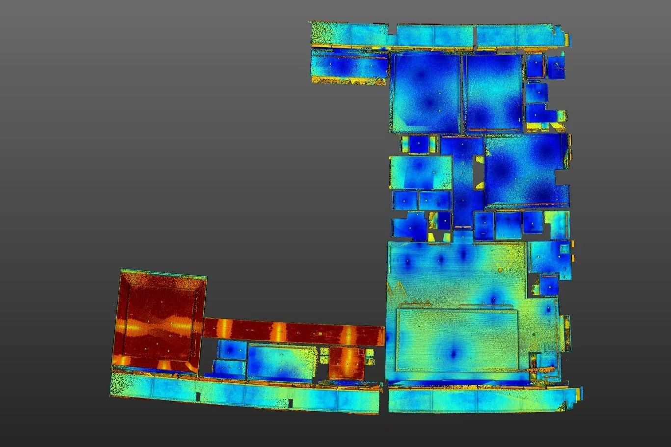
Site photo · Dervoss
04 — Real project · Dubai
A villa in Dubai was going through a full renovation and replanning. Before design work started, the team needed the exact as-built geometry of the residence: walls, floors, ceilings, openings, staircases and structural deviations.
The architects and engineers could redesign the floor plans with confidence, run clash detection, take accurate quantities and compare renovation options in 3D, with fewer surprises on site.
Point cloud + Revit BIM model (LOD 300 to 400)
Read the case study05 — How it works
Step 01
We survey or scan your site with survey-grade instruments: every surface and dimension captured in a single visit, with minimal disruption.
Step 02
The field data is processed, registered and checked into one accurate dataset, the verified foundation everything else is built on.
Step 03
Our in-house team produces your deliverables (drawings, maps, reports or Revit models), reflecting exactly what is on site.
Step 04
You receive your files in the agreed formats, with an accuracy statement. We stay available for revisions and questions after handover.
06 — In detail
A day of scanning produces dozens of individual scan positions, each in its own coordinate frame, full of passers-by, reflections and stray returns. Processing is what turns that pile into an asset: positions registered into one frame against control, errors quantified rather than hoped away, noise cleaned out, colour balanced, and the result decimated and structured so Revit or Navisworks opens it without choking. The full-colour cloud pictured above (clean enough to read edges, materials and MEP elements) is what “processed” means in practice.
| Raw scan data | Processed point cloud | |
|---|---|---|
| Coordinate frames | One per scan position | One registered frame, tied to control |
| Accuracy | Unquantified | Measured and reported |
| Noise, people, reflections | All still in the data | Cleaned out |
| File behaviour | Chokes Revit/Navisworks | Structured, decimated, loads clean |
| Usable for modelling/QA | Not reliably | Yes, engineering-ready |
Most of our processing feeds Dervoss’s own scanning and Scan-to-BIM work, but we take third-party data on the same terms. Send us scans your team captured and we’ll register, clean and QA them, with one honest caveat: we’ll tell you upfront if capture quality limits the outcome, before you spend on modelling. Every delivery, ours or yours, ships with a measured registration accuracy report, because a point cloud without a stated accuracy is a picture, not a survey.
07 — Why Dervoss for point cloud processing
One team from site capture to finished drawings and BIM models. No hand-offs, no offshore modelling shops, no gaps between what was scanned and what was drawn.
01
No hand-off between a scanning company and an offshore drawing shop: the team that measured your site produces your deliverables.
02
Trimble X9 laser scanning and survey-grade instruments, accurate to ±2 mm, with an accuracy statement per delivery.
03
All seven emirates, Saudi Arabia and the wider GCC, with deliverables prepared for local authority requirements.
04
On site within 24 hours of a confirmed LPO; urgent concrete and utility scans often same-day.
08 — Questions
Point cloud processing turns raw laser-scan data into a clean, registered, ready-to-use point cloud: the difference between data you captured and data you can actually work with.
Registered and cleaned point clouds as .RCP and .E57 as standard; conversions to other formats on request.
Yes: we register, clean and QA third-party scan data, and tell you honestly if the capture quality limits what can be done with it.
It depends on the size of the dataset (number of scan positions and area covered), the capture quality, and what you need from it: registration only, full cleaning and QA, or format conversion on top. Send the data details and you get a fixed quote.
Registration aligns the individual scan positions into one consistent dataset; cleaning removes noise, reflections, moving people and equipment. The result is a dataset you can measure and model from with confidence.
Every delivery ships with an accuracy report documenting registration quality; the figure is measured, not assumed.
09 — Get a fixed quote
Describe the job in your own words; you don't need to know the right survey name. A fixed price and a committed delivery date, no obligation. Plans or photos? Send them on WhatsApp.
On site
Within 24 h of a confirmed LPO
Office
Al Barsha South 3, Dubai
Hours
Mon-Fri 10:00-18:00